For the second time, I have climbed a Munro in a group as large as five: The first, with Pat and our boys, and my last, with Mike Milmoe (who helped me invaluably), my wife Pat, who accompanied me on 191 Munros, and Hazel Gibbs and Pauline Wilson from SYO
Click here for Gallery of pictures from Beinn Bhuidhe and the Loch Fyne Oyster Bar Pictures by Hazel, Pauline, Pat, Michael and me.
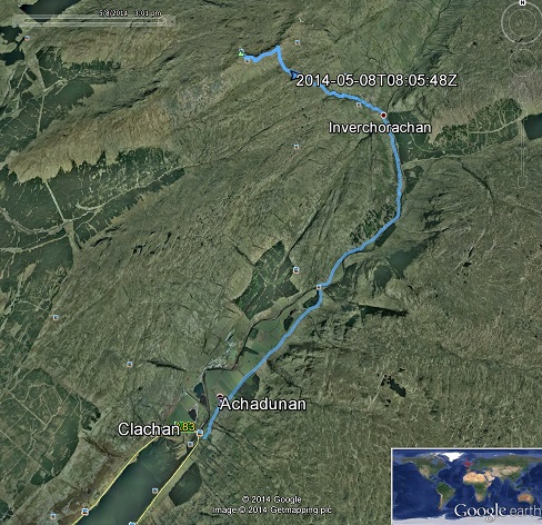
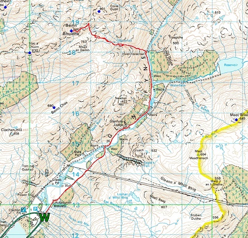
Google Earth view of route OS map view using Memory Map overlay
The OS map is reproduced by permission of Ordnance Survey® on behalf of The Controller of Her Majesty’s Stationery Office. ©Crown copyright 1974-2002. All rights reserved. Licence number 100047659.
Links for downloading files for use in GPS device or in computer map program Route file1 (up and part way down) Route file2 (complete plus next day)
Timings (as requested by Michael)
Cycle 5.5 km in about 24 minutes 65 m climb from sea level
Walk to Inverchorachan, 1.7 km (7.2 km), 37 min (1:02) 35 m climb (100 m)
Summit 4.2 km (11.4 km), 3:09 (4:11) 840 m climb (942 m)
Celebrations/lunch/champagne (thanks to Web-Blinds.com*)/strawberries (thanks Hazel)
Return by upward route
Summit to Inverchorachan 2:50
Inverchorachan to bike dump: 0:31
bike dump to parking: 0:20
And then on to the Loch Fyne Oyster Bar!
Note: cycling to gate where you are asked to leave your bike is mostly tarmac, rough but hard surface for the last 500 m, and no steep slopes. The track to Inverchorachan could be cycled, but has stiffer climbs.
And next day, despite rain forecast, we went to Killin and up Meall nan Tarmachan, for Pat's 192.
* From Facebook, 3 July 2013:
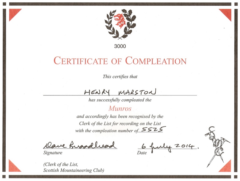
My certificate of compleation: