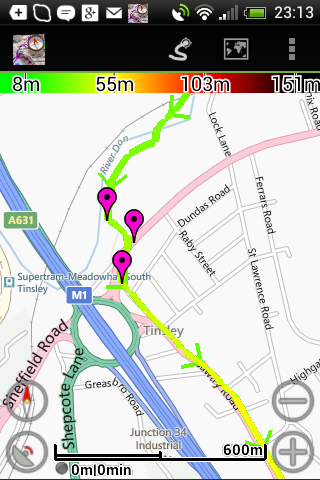
Screenshots on an HTC Android phone using the MyTrails app,
with FREE map - take your pick.
Plus a photo of the Memory-Map screen -
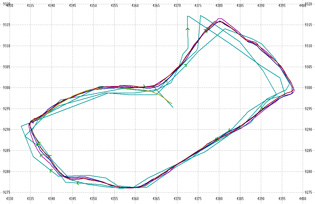
 |
 |
 |
| a) Microsoft Terrain | b) Microsoft Map | c) OpenStreetMap |
 |
 |
 |
| d) 4UMaps | e) Google Map | f) Google Terrain |
 |
 |
 |
| g) OpenCycleMap | h) OpenHikingMap | i) Photo of Memory-Map screen showing OS map* |
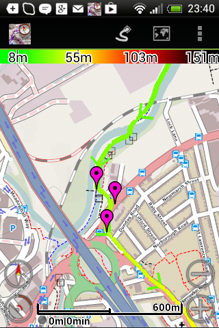
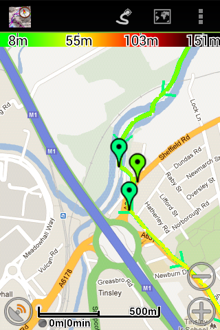
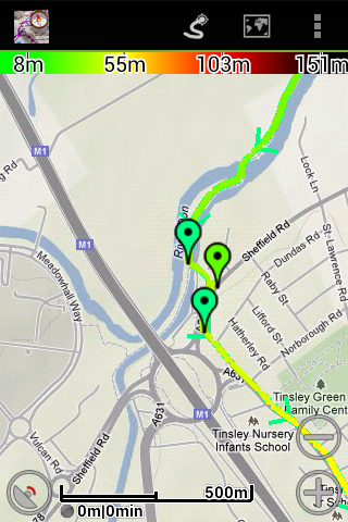
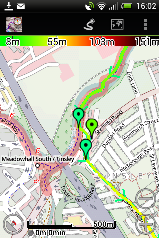
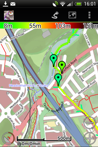
For the MyTrails displays here, the track (where I went last year) is light coloured because of the low altitude near the river; it is red or black at higher elevations. The colour can be set to a single selected colour (as on the RRR home page)
This section is being developed - email rrrhenry-at-hmarston.co.uk and I will try to help.
The following description is
probably only meaningful if you have a SmartPhone or Tablet! It is based on an Android phone (HTC Desire C
and Sony Xperia), but no
doubt similar for other Android models.
Three downloads are required
a) a suitable app
I have tried three apps. My
Tracks (linked to Google Maps) is easy to use for recording runs, but it is not
easy to upload a route. It was also too responsive to inadvertent screen
pressings. On enquiring about loading a route to RunKeeper, I was advised
to keep to MyTrails! My Tracks and RunKeeper are more concerned with
sharing your experience than following a route, and do not have all the features
described here. MyTrails is an Android app produced by
FrogSparks, downloadable from the Play Store.
Information here is summarised from the MyTrails manual, which can be accessed
from the
Remember, I am describing MyTrails for Android,
not My Tracks or Trails/MyTrail for the iphone. They are quite different!
I have seen a report of Motionx for iphone/ipad being used successfully without
additional maps beyond the Apple map.
b) maps.
MyTrails
offers many different maps, many free, but you can subscribe to the OS 25k and
50k maps for a monthly fee. The free map I prefer for the RRR is OpenStreetMap, which shows
many footpaths. Mapquest is very similar, with 4UMaps a good alternative.
See examples above, the Google versions being done later, different track file.
For hill-walking or fell races, I would want a Topo map, with contours, e.g.
OpenHikingMap (Europe), more visible footpaths. Consider: The
map may not be easy to read if it is sunny (as has often happened!) so
photographic depiction of terrain (as in Microsoft Map) would not be easy to
follow. Brighter screens use up the battery more quickly! The
railway is not easy to see on Microsoft Terrain or Google Map, and omitted from
Google Terrain - not ideal as they can be useful navigation aids.
You can invest Ł12 per year, (Ł1.50 per month) for 1:25k and 1:50k OS maps, but
I plan to try the free maps first.
c) the
route for this event (right click on the link
and 'save link as..' so that you can save the file)
F
Procedure:
Install MyTrails (free) and
ideally add
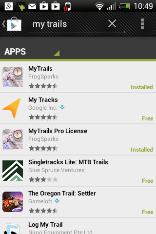
In PlayStore, search for 'MyTrails' (no space)
Download the
Typically, download the route file to a PC, copy it to your dropbox and when
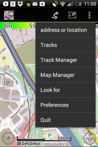
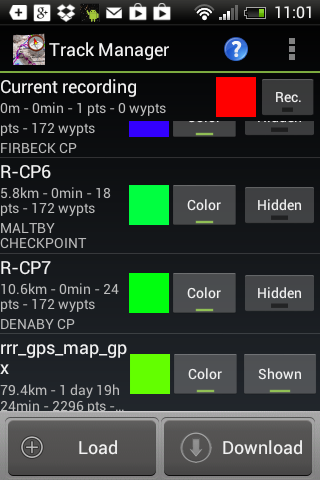
transferred to your phone. Open MyTrails, open the menu (3 dots one above
the other, top right), select Manage tracks, select Load, find the appropriate
route file, and load it.
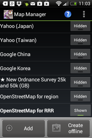
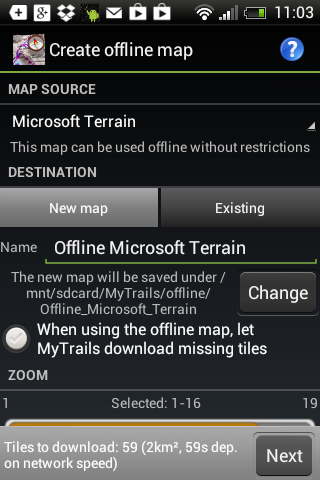
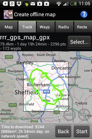
To create an off-line map, select
Map Manager from the menu. Click Create Offline. Click below Map
Source, select the map you want (e.g. OpenStreetMap in place of Microsoft
Terrain), edit name (e.g. RRR Offline). Click Next. The map to be
created offline will be displayed.
In Preferences, sub-menu Behavior, you may want to set GPS Orientation (direction of travel up screen, not North), Disk Cache Very Large, and under Waypoints Proximity Location (e.g. Vibrate and speak or Vibrate and ring). Under Other, Keep screen on (dim) will give quick restart; Let phone sleep will save battery power, but then the Proximity Alert won't work. To prevent accidental input on touch screen, set Screen lock (unlock with 'volume up' key). If MyTrails is not on top, ringtone volume slider may display; press bottom left Back button. Don't set Optimize battery or you will lose the proximity alert. (American mis-spellings taken from app!)
To start recording your track,
click the left-hand of the group of 3 buttons at the top, like an electrical lead or
snake.
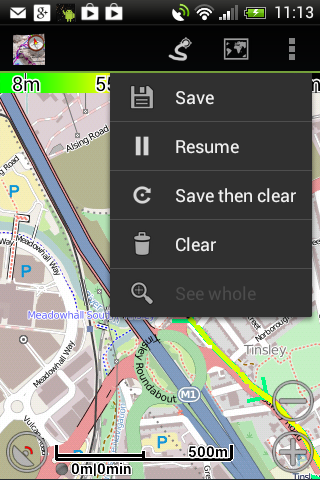
Click Clear to remove
Use the + or - buttons to zoom in or out, or use 2-finger swipe. A short swipe will briefly remove the track so that you can see the map detail behind the track. The colour of the track is altitude related, scale along top of display. Black and Red at the top of the hills, green and yellow on low ground. The other button (circle with sat receiver) centres the current location in the display.
 |
 |
 |
|
Clear to reset, Save then clear if you want the previous outing saved. Resume to start (Pause to finish). |
|
|
 |
 |
 |
|
|
|
f) Click Track (instead of Map), then find RRR Track. Map to be created is based on track |
Helpful Hints:
To see the map behind the track, slightly adjust the zoom (pinching the screen
with 2 fingers), the overlay will redraw, but you have an opportunity to see the
underlying map
You can set up several alternative maps to be available (shown rather than hidden). These are listed under the map icon (between snake and menu icons). The nifty way to swap maps is a 'lateral 3 finger swipe' across the screen.
During daylight hours, wear sunglasses so that your eyes are able to adapt to the phone's display. When you want to look at the screen, hold the screen in shadow and remove your glasses. The back-light can't compete with the sun! (not a problem with certain handheld GPS units like a Garmin GPSMAP)
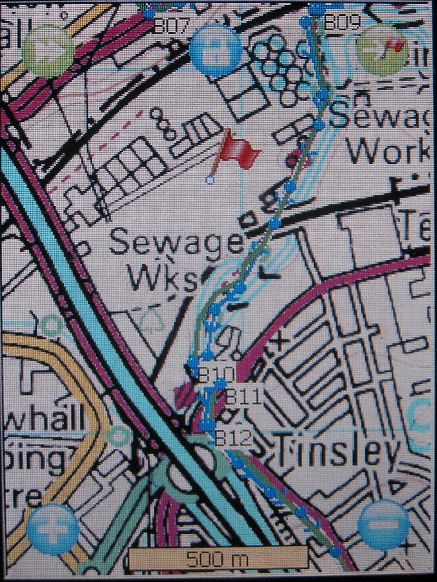
For the MemoryMap Adventurer, connect it to your PC and upload RoundRotherhamRoute.mmo to the User Data folder on the device (click on link and Save File As.../Save Link As...)
After disconnecting and restarting, on the Maps
page, click the Tools icon, Overlay, Open and select
The area is still under development, and will be expanded upon before the event. Contact me, Henry Marston, if you have problems with the software or maps; I may be able to help.