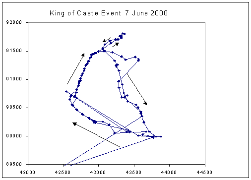
For the first time, GPS has been used to get an estimate of the length of a RHAC event. Carrying a GPS unit round the off-road 2 lap course, I got this result (I think the link now works):
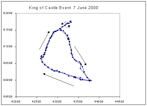
Obviously some points were incorrect, probably points calculated after emerging from tree cover before the unit had settled down again. Sometimes the signal from one satellite can reflect off a wall or similar (which may account for the difference in Boston Park on the 2 laps). Correcting obvious errors, the pattern became:
| Start | 271 |
| Lap 1 | 4278 |
| Lap 2 | 4336 |
| Finish | 245 |
| Total | 9130 |
How does this compare with other measurements? (the 'run round and record a track' tachnique canot be recommended. Instead, stop at each change of direction and save a waypoint averaged for (say) 10 seconds.
Comment: if repeating the exercise, I would set a fixed time interval. At a uniform running speed, points would then be uniformly spaced, and tight spacing would indicate slower sections. Poor GPS coverage would also be obvious because the time interval would be increased (the unit only saves points when the signal is good, and can think the signal is good before it is real good)
| Class | Posn. | Name | Time |
| Open | 1 | Chris Parkes | 34:23 |
| 2 | Richard Harris | 35:05 | |
| 3 | Phil Roberts | 37:57 | |
| Ladies | 1 | Janet Hindley | 43:22 |
| 2 | Gillian Bunker | 46:41 |
| Class | Posn. | Name | Time |
| Open | 1 | Phil Smales | 19:31 |
| 2 | Terry Hawley | 20:25 | |
| Ladies | 1 | Janine Craythorne | 26:46 |
| 2 | Lesley Day | 26:47 |